forcebwithu
-
Posts
4,705 -
Joined
-
Last visited
-
Days Won
116
Content Type
Profiles
Forums
Events
Everything posted by forcebwithu
-
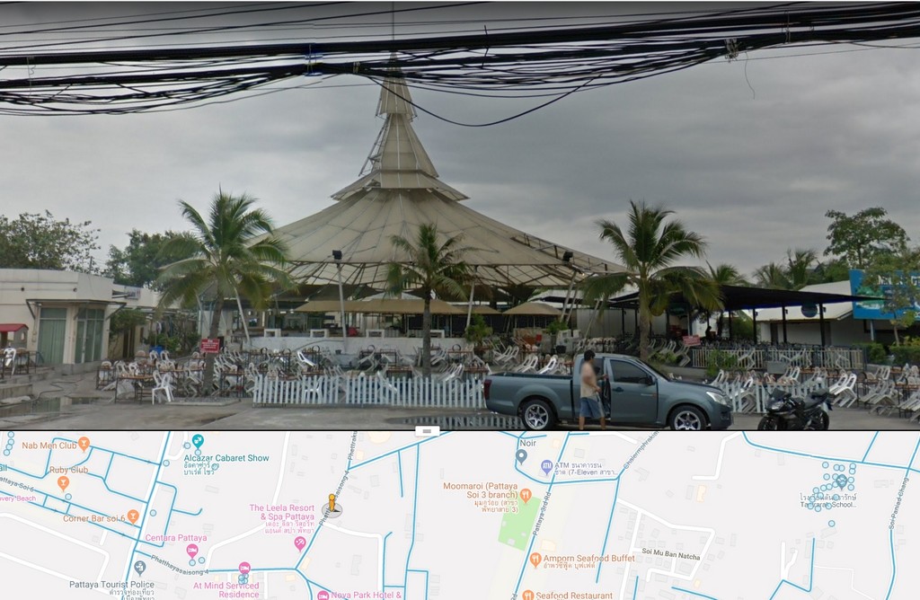
Thanks. Got my Tai's and Nua's reversed. Corrected the post. BTW, the Street View of that location is from Jan, 2018. Some parts of Pattaya may be still from 2012, but the Google Street View car has been back since then.
-
From the description it sounds like this place on the soi that runs behind Big C from Klang to Pattaya Tai Nua. https://www.google.co.th/maps/@12.9421108,100.8911396,3a,29.8y,104.47h,97.37t/data=!3m9!1e1!3m7!1sGbp-1cvnKqzKSG3ADpq0tA!2e0!7i13312!8i6656!9m2!1b1!2i34?hl=en

-

Bike Paths & Routes Around Pattaya
forcebwithu replied to forcebwithu's topic in General Discussion about Pattaya
I don't believe so as I didn't see any indication of a rental shop. The building is certainly big enough to house a rental shop though. -
Bike Paths & Routes Around Pattaya
forcebwithu replied to forcebwithu's topic in General Discussion about Pattaya
Siri Charoenwat Forest Plantation Path I finally made it out to the newly re-opened Siri Charoenwat Forest Plantation bike path, located near Chi Chan Buddha Mtn and Silverlake Vineyard. I have to say I was impressed. It's a beautifully maintained, tarmac surfaced, 17.2 km loop that takes you through some very scenic countryside. Best of all, at 9 am on a Thursday I had the bike path to myself. Didn't see another soul in the hour it took me to do the loop. The bike path is of medium difficulty with a lot of 5%+ slopes, up and down. Fortuantely the steeper slopes are relatively short. The entrance is off of 1003, which is the road that takes you by Chi Chan Buddha Mtn and Silverlake Vineyard. Riding the bike path is free, but you will need to register before you enter the path. You'll be asked for a Thai drivers license or passport, which they'll hold until you finish your ride. The registration desk is on the left side, just inside the main entrance. Once registered, your ride starts just to the left of the entrance. Note also the trail is one way. Once you enter, there's no turning back. This is for safety reasons as the majority of the trail is sweeping, blind curves. It would really suck to come flying around a curve only to meet up, headlong with some numb nuts going the opposite direction. Ride around the builing, then make a 180 degree left turn to get on the bike path. I'd say 90% of the trail is tree lined, and well shaded in the early morning/late afternoon. The trail is well marked, with warnings of steep slopes ahead. According the Google Earth, the max slope is 17.7% with an average slope of 5%. Don't let the 17.7% scare you off as I don't even remember where on the path that was. As mentioned before, all the climbs were very short in distance. They must have had a fire sale on 8% signs, as every steep slope had one, regardless of what the actual % slope was. What was great about this path is pretty much everything was gently sweeping curves with great views. Other than occasional leaves on the path, I didn't encounter any other debris such as sand or tree branches. You do need to be mindful of the leaves though as you can get up quite a bit of speed on the sweeping downhill turns. It would sure ruin your day to loose traction on a couple of leaves and wipe out. Very considerate of the trail designers to cut a path through the higher points. It would be some tough climbs otherwise. The path has two rest stops. One at just over 10 km. And the other at 14 km. Near the end you'll be treated to a view of Buddha Mtn and Ramayan Water Park in the distance. While the trail is well marked, about one km from the end they're missing a turn arrow to direct you back to the start. The direction you want to go is right when you see the pond. -
Sure hope the system here is more stable than what I see over at PA after their upgrade. They're still struggling with issues that bring down their forum almost every week. Just tried to log on now and get an Internal Server Error. Not sure if it's inadequate hardware or an incompetent forum admin.
-
Good luck with the upgrade. If you are able to do this in under a day, a big pat on the back to you.
-
My guess it was more to mitigate the risk of carrying large amounts of cash back to BKK.
-
Thanks nkped. Good to see our US Embassy people working with Thai immigration with regards to the proof of income requirement. Interesting to read one person reporting he was successful using US bank statements as proof his average monthly income met the 65k/month requirement. Wonder if that would work at other immigration offices.
-
^^^ I thought the follow on song was hilarious.
-
Had a look at this one. Interesting and quirky, which is to be expected with the Cohen brothers writing and directing. Really liked the first two shorts, The Ballad of Buster Scruggs and Near Algodones, but then found myself fast forwarding through the next two and then gave up on watching the remaining two.
-
Visisted the New Terminal 21 Mall Yet?
forcebwithu replied to jacko's topic in General Discussion about Pattaya
Corner of Pattaya Nua and 2nd Rd -
I've been living here for about nine years now. I make several trips each year outside of Thailand. Other than my landlady doing the initial TM30 report a few years back, I nor my landlady has ever notified immigration of my return to Thailand. To date this has presented no problems when I go for my annual extension to stay. The most recent one was two days ago.
-
With the main characters sitting around complaining how good it was ten years ago and how much prices have gone up. Expect Al to chime in with how he always got his BJ's for free.
-
Bike Paths & Routes Around Pattaya
forcebwithu replied to forcebwithu's topic in General Discussion about Pattaya
Venture Bike in Jomtien looks to have a decent selection of bikes for rent. -
Bike Paths & Routes Around Pattaya
forcebwithu replied to forcebwithu's topic in General Discussion about Pattaya
Khao Mai Keao Route I had a nice ride this morning on a route around Khao Mai Keao. The main thing this route has going for it is once on the north end of KMK you have a very enjoyable ride that's mostly a gentle downhill all the way to Hwy 7. The route can be found and downloaded from Google Maps using this link. RT distance starting and ending at Pattaya Klang and Sukhumvit is about 59 km. It's a relatively easy ride with only a moderate amount of elevation gain near the south end of KMK. The first part of this route takes you up Soi Siam Country Club road. While there is no marked lane for bikes, the road is quite wide giving you a comfortable separation from passing traffic. Along the way you'll pass what once was a darkside favorite, the Butterfly Bar. Just before you reach Map Phrachan reservoir you come to the construction site for the hwy bypass from Hwy 7 to Rayong. To avoid the very muddy dirt road that's being used to divert traffic around the construction, veer to the right around the construction barriers. What you'll find is a very serviceable tarmac road. A much nicer ride on two wheels to what the rest of the traffic is using. Another benefit is the shade the overhead highway provides. If you're so inclined, a couple hundred meters past the construction site is the entrance to the road running across the reservoir dam. To the left of this road is some nice mtn bike trail, something I'll ride and report on in a future post. Another good thing about this route is along the busy roads you have a wide shoulder to ride on that is relatively clear of debris. Mark your calendar as next weekend is the Chonburi Buffalo Races. The race grounds are on the south side of the reservoir. Looks like some contestants have arrived early and are fueling up for the big race. Anyone that fancies a game of cricket, now you know where to go. Just past the 3240 junction is the previously posted Bang Lamung Exercise Park and bike path. Since I was in the area I thought I'd make a quick diversion and check out how trees have filled in since my last pics from 2016. Back at the 3240 intersection with SCC road. From the intersection to the south end of KMK you have a fairly easy climb spread out over about 6 km. At the top of the climb you'll see the Rugby School off to your right. Once on Hwy 331 you'll again have a wide shoulder to ride on. Reaching the north end of KMK your next turn is on to Rd 1015. From Klang you're now at the approx. halfway point, so time for a break and refueling. Just after you make the turn onto 1015, there are a couple of mom and pop stores to rest at and make your purchases. My favorite concoction is to mix soda water with Sponsor energy drink. I find energy drinks too syrupy sweet on their own, but by mixing it with soda water it dilutes down to something more palatable. For this section of the route there isn't any shoulder to speak of, but as there is very little traffic that doesn't present a problem. One thing to watch out for is in several areas rain has washed sand into the road, and it can cover a fair bit of road. More than what you see in this pic. For the trip from here to Hwy 7 you'll have a mostly gentle downhill ride with some nice curves along the way to keep it fun. There's a long section that, tucked down on the aero bars, I was able to cruise along at 45 kph w/o having to pedal once. As you get closer to Hwy 7 you'll start to see more pallet manufacturers, thus the nickname of Pallet Lane for this road. When you get to Hwy 7 you'll ride a very short section of the frontage road. Just before the first bridge there's a dirt track that you'll need to take to exit the frontage road. Correction, muddy dirt track. It's a PITA to ride, but it's only about 200 m and then you're back on pavement. Back on hard surface again you'll be treated to a view of the west side of KMK. Your next turn isn't marked, but is about 800 m from the dirt track. For those that are interested in where all the money from Tony Gyms barely used and then abandoned, lifetime gym membership goes. If you continue on a short distance past the turn you'll see the roof top of Tony's palatial estate. You really can't see much of anything from the road due to high security walls and foliage, but from space you can see just how large his place is. From this point it's a couple of back roads that will get you back to SCC road. Turns are marked well with signs. First turn to the left at a roundabout. The sign points you in the direction of Hwy 36. It used to be you could shoot straight across Hwy 36. But no longer. Instead you have to use a U turn about 200 m up the road. It's not as bad as it looks since traffic isn't moving too fast due to construction. Once construction is done though I imagine it will be a bit more dicey using the U turn. Having made it safely across Hwy 36, next turn is again to the left towards Nongprue. A short distance later you'll come to the intersection with 3240. Hang a right and keep an eye out for the Black Pearl Bar sign. Not a bad place to stop at if you need a beer and want to cool off in their pool. If you want, you can have female company to help clean you up. Continuing on though, just past the Black Pearl is the road that will take you back to SCC. At the intersection with SCC continue straight to the T intersection that is the top of Soi Nern Phlap Whan, with a Wat on the left side. Side note: the Wat is the meeting place for the Monkey Extreme Bike Riders rides. After several hours in the saddle I usually like to relax with a massage. On Nern Phlap Whan, just before the railroad is a one of my favorites, Turien massage. Enjoy and ride safe. -
Good explanation and good that sailingbill is asking for clarification now as I didn't and ended up invalidating my O-A Visa. Really sucks to be told on coming back to Thailand my visa was no good and only getting the 30 day stamp. What I didn't understand then, but what what you explained quite well is the visa expiration date and its effect on the 12 month permission to stay. The key thing to remember is to get a re-entry permit before you leave the country once past the visa expiration date.
-
Good to see Nam's good service is being rewarded with more customers switching to her. Be nice if more Thai businesses would follow this business model.
-
My bad. I just focused on no tips and visa agents and completely glossed over "Letters of income used for a retirement extension will require proof from banks". Looks like I'm in the same boat as sailingbill. My extension is up next month, so I'll be quickly finding out if I too need the additional proof. Edited to add: I re-read the linked article in the first post and don't see any mention of additional proof from banks. Do you have another source for this new requirement?
-
The income affidavit is all you need for the extension. Never been asked for additional proof of income.
-
Bike Paths & Routes Around Pattaya
forcebwithu replied to forcebwithu's topic in General Discussion about Pattaya
Thanks for the feedback. I really enjoy biking in and around Pattaya, same as when I lived in the States. Here I can ride year round and take advantage of that by riding almost everyday. Most days are relatively short rides, 20 - 30 km. I've been lucky during the nine years living here I've only come off my bike a couple of times with no serious injury, and I've never had an accident with another vehicle. Mostly that's due to luck of not being in the wrong place at the wrong time, but a good part is practicing safe riding. Number one is riding with a mirror. Number two is anticipating some doofus is going to do the unexpected, which I've seen a fair share of. Cheers all and be safe out there. -
Bike Paths & Routes Around Pattaya
forcebwithu replied to forcebwithu's topic in General Discussion about Pattaya
Another bike path in the Pattaya area is in the Bang Lamung Exercise Park along the northeastern shore of Map Phrachan Lake. The path opened in early 2016 and is a very easy 2 km loop through the park. The route as recorded by my GPS can be found on Google Maps (link). The pics in this post were taken in April, 2016. I rode the loop about two weeks ago and I'm happy to report the path is still in great condition. The trees have also filled in nicely to provide plenty of shaded areas. Enter and exit the bike path from the left and right off the main entrance to the park. The direction of travel is clockwise and is marked with arrows on the path. They've done a nice job of landscaping the park. There's a small play area for the kids. While the path isn't long in length, it has several branches to keep it interesting. Other than a couple of workers watering, I had the park entirely to myself. It was very peaceful and quiet while I was there. In 2016 the lake was at one of the lowest levels I've ever seen. Water levels have since recovered to normal, and two weeks ago I noted the swim platform was again floating, although in a different location. The long term plan is to eventually build a bike path around the entire lake. Looking forward to the day when this path extends to the north. And the south. Once the crowds come this might be an interesting corner to kick back with a beer and watch the confusion. The park also has a nice football pitch. Here's a Google Earth pic of what the park grounds and path looks like as of February, 2017. -
For those interested in biking around Pattaya I thought it would be good to have a thread detailing the bike paths in the area. To date I only know of three (one of them currently closed), but I imagine in the coming years more will be built. This post is about the new path just constructed in the Wat Yan/Silver Lake area. It's advertised as a 13.6 km route end to end. The route as recorded by my GPS can be found on Google Maps (link). Except for the part that starts at 331, the bike path is a relatively easy ride. Here's a screen shot of the elevation profile. Note the double peaks at about 10 km and 27 km are the result of me reaching the end of the bike path at 1063 and 331, turning around and going back up the hill I had just rode down. Here's the beginning of the bike path at route 1008 and Sukhumvit. Of course TIT so I only had to go about 50m when I encountered the first obstacle on the path. Surprisingly though I only encountered maybe half a dozen parked vehicles on the path during my ride. There were a couple of places, RR crossings and bridges, where the bike path ended and you were left to ride in the road with no shoulder as a safety margin. While the path did have debris and sand on quite a few stretches, there was usually a clear path on the ride side of the path. Here's a pic of perhaps the worst amount of debris I encountered. Note how the lane on the opposite side is pretty much clear. Probably due to store drains built into the curb rather than down the middle of path. One pet peeve of mine is the disregard road builders have for those on two wheels when orienting drain grates. When they're parallel to the direction of travel they're an accident waiting to happen if you ride over them with a bike that has skinny tires. Coming into the Wat Yan area you have a choice of continuing on straight to Wat Yan or taking the path to the right which takes you around the lake towards Chi Chan Buddha Mtn. Not sure why they went to the trouble and expense to make a new path to the right when they already had a perfectly usable, and more scenic path about 50 m up the road. It runs along the shore of the lake and is closed to vehicle traffic. On the approach to the Wat Yan you have a choice of continuing straight into the Wat area or bearing to the left which will take you to the northern end of the path. The northern path has a bit of climb, with a slope that maxes out at about 6% grade. Once to the top you're treated to a nice view to the east of relatively undeveloped land. Although I expect that will soon change in the not too distant future. And the ride now brings you to the northern end of the path. From here there are some very nice, low traffic back roads you can use to get back to Pattaya. Ok, now to fast forward the ride back to the entrance to Wat Yan grounds. There's a short stretch here with the bike path on only one side of the road. It may be hard to see in this pic, but the bike path is on the sidewalk. That's sure to get the blood pressure up for those that say a bike has no place on a sidewalk. In fairness, the law does state no biking on sidewalks so not sure how the road engineers got around that. Of course, TIT. When you get to the white chedi start looking for the bike path to split again. The road markings aren't the best, but it doesn't really matter as all the path does at this point is make a short loop through the Wat grounds. It's on this loop though that you have the option of leaving the bike path and continuing on a very scenic road that ends up out on 331. The road is at the top of the parking area and passes between the two buildings you see in the pic below. Next stop on the ride is Chi Chan Buddha Mtn. Leaving the Wat grounds you'll hang a left at the previously mentioned scenic path along the eastern lake shore. When the path intersects the road, turn left. Note the helicopter landing pads along the southern shore. Kind of a strange place for landing pads, but I have seen them used for military training a few times. If riding from Pattaya, this usually is a good time to stop and give the legs a break. A good pit stop is the small group of stands across from Viharnra Sien. First time I had Coke w/Coffee. The combination tasted pretty good. Legs rested and the caffeine and sugar fix doing its thing, it's time to move on. On this stretch you'll be treated to good views of Buddha Mtn as you make your way on the winding road. One would even be tempted to think it's a relatively flat stretch of road. But you would be wrong when you round the last bend and see a nice climb ahead of you. This one is a bit harder than the last hill, maxing out at about a 9% grade. With perseverance and a lot of sweat and leg power you'll soon make it to Chi Chan Buddha Mtn. Past the Buddha Mtn you'll then enter wine country. Here the bike path is quite a bit older and the surface not as smooth as the new path. Ok if cruising along at a slower clip, but on these slight downhill stretches I can easily move along at 40+ KPH, which would make for a bumpy ride not to mention the hazard of hitting some obstruction on the path. The view of Silverlake Vineyard and surrounding country is well worth a stop and a few pics. Leaving the vineyard it's now time to make our way to the eastern end of the bike path at 331. Side note: off to the right in the pic below is the Siri Charoenwat Forest Plantation. The Plantation used to have, until about 2016, a great mtn bike dirt trail. Then about a year ago they completed paving of the trail. Unfortunately it was only open a short time until they closed it for "maintenance". Word now is it's permanently closed as it was deemed too dangerous with mud slides, huge cracks and debris on the trail. I also heard heavy construction equipment was using the trail. Let's see, heavy equipment moving around on a trail built for bikes. No surprise then the trail developed huge cracks. Here's a link to an article about the trail. Along this stretch you'll encounter rolling hills which you can almost make the top of the next hill w/o too much effort if you enter with enough speed from the last downhill. The final downhill stretch is your chance for speed, if that's your thing. Max grade is 20% which allowed me to clock a max speed of 68 KPH. If there's any doubt you've reached 331, there's a helpful sign 100 m from the intersection. One last section of the path to log and that's getting back to Sukhumvit on 1003. What really sucks though is to get there from here I need to go back the way I came. That means going back up the 20% grade I just blasted down. Pictures never do justice when facing steep hills. But the sign "Use Low Gear" is spot on. Sadly I succumbed to fatigue about 2/3 of the way up and, shame of shames, had to walk my bike up the last bit. Top of the hill and back in the saddle again, quickly made my way past Silverlake and Buddha Mtn. Just past Buddha Mtn there's a sign telling me only 6 km to Nong Nooch Gardens. Note the blue sign about 100 m farther up the road which I have a close up of in the next pic. Must have hit a space warp between the two signs as the next sign tells I'm now 5.3 km, 700 m closer to Nong Nooch after only traveling 100 m. If you're into tourist attractions, there's this along the way. Personally I found the view across the road of Na Jomtien, Jomtien and Pattaya more interesting. And finally, after 36.5 km the end of the bike path and Sukhumvit is in sight.
- 40 replies
-
- 10
-

-
Best flights for me were 747 upper deck, BC. Like another poster stated, it's like having the entire plane to yourself. Shame they've been retired from passenger service, but I have to say the newer planes with lower altitude pressurization and higher humidity levels make for a much more comfortable long haul flights. Worst was a US domestic flight. Guy next to me was so drunk the FA's refused to serve him. I called him out when he nicked a couple of bottles from the cart when the FA's weren't looking. Under different circumstances I wouldn't have gotten involved, but he was already a belligerent drunk and I could see it only getting worse. The guy then started into me verbally. When the FA's asked if I wanted to move, I looked directly into the guys eyes, smiled and said no thanks, if he gets too much on my nerves I'll give him a sedative by way of an elbow to his face. The threat worked as it shut him up for the remainder of the flight. Unfortunately for him, the flight crew had alerted airport police who promptly arrested him once we landed.
-
Day time beer bars similar to nana soi4
forcebwithu replied to accyboy's topic in General Discussion about Pattaya
I'm biased to the Soi Buakhao area. Quite a few to choose from. In no particular order and off the top of my head; Easy Corner Bar, Nikom Court, Katsiree, Sutus Court, Billabong, Triangle Bar, and the newest addition that looks to have potential but I've not yet stopped at is Pook Plaza. -
Watched and enjoyed Billions. I'll put Peaky Blinders in the queue.